Converting a WMS URL to a WFS Request
How to change a WMS URL to a WFS URL
This week I saw a new mappy meme:
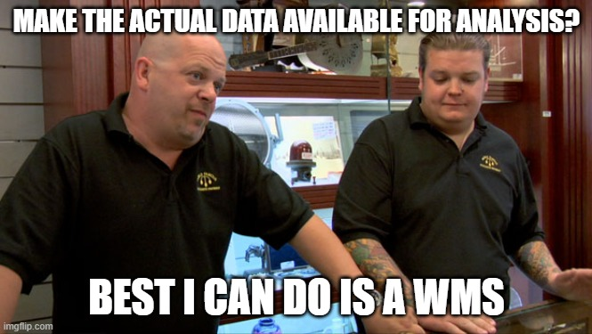
and I had a quiet snigger and then made a throw away tweet, that it is usually pretty easy to back engineer the related WFS URL from the WMS one. To be honest, I thought everyone did this as a standard part of their data analysis day to day toolkit. But from the responses I saw apparently not everyone knows how to do this. So, I thought I would write a post explaining some of the basics of how WMS and WFS URLs work.
First, find some data
For an example, I went to data.gov.uk and filtered for WMS. After a couple of false starts, I picked Fish
Landings to United Kingdom Ports 2014 Web Mapping Service
(WMS)
which contains:
Annual statistics for commercial fishing activity by UK registered fishing vessels for the year indicated.
Which to be honest sounds like it should be a CSV file (but that is a rant for another day). The Marine Management Organisation provide a WMS link which we can also preview on their map.
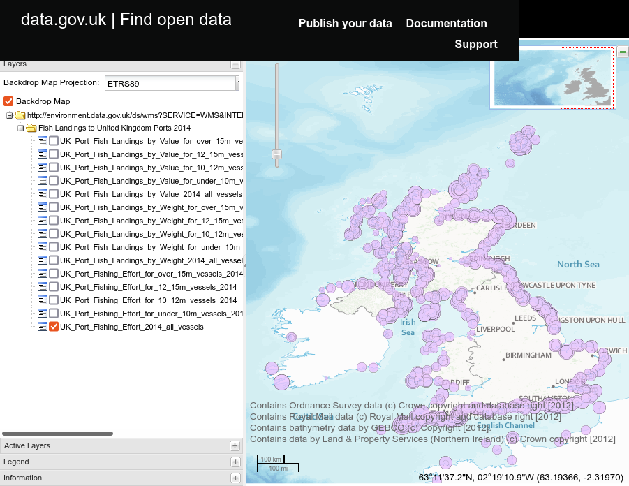
But we want the data not a picture of the data (especially not that picture)!
How WMS works (a side trip)
Before we can start deconstructing URLs we need some background knowledge about how WMS and WFS work. You may
have seen WMS used in web browsers or QGIS where you get asked for a capabilities URL or a base URL. This is
some times what you find on data sites, unfortunately there is a subtle difference between the two and
experienced professionals have met them so often that we forget to mention them most of the time. If we
examine the URL on the data.gov.uk page we will see:
http://environment.data.gov.uk/ds/wms?SERVICE=WMS&INTERFACE=ENVIRONMENT--e9f68cafd7e937c07e697439493ff06d&request=GetCapabilities
Which is a capabilities URL, that is it will return a GetCapabilities document (an XML file) which a smart
client can use to work out which layers, styles and projections are supported by this server. A base URL is
the part to the left of the ? which is the machine name and the path to the server end point, when people
give you this it means they expect you (or your client) to be smart enough to build a GetCapabilities
request URL from this information and your knowledge of the WMS
specification.
I’ll run down the required parameters for those of you going TL;DR on that 85 page PDF.
The WMS standard requires that a WMS server provides a way of asking for the capabilities of the server and since you currently have no idea of what the server can or can’t do yet it needs to be easy. There are two required parameters:
REQUEST- this tells the server what you would like it to do, there are many options for what can go in here but all OGC services (before version 3) must supportGetCapabilitiesas an option, and they return a well structured XML file to the client making the request.SERVICE- this tells a server with multiple end points which of it’s services you would like to talk to, again there are many possibilities but in our case it will beWMS.
There is an optional VERSION parameter that you can send if there is a highest version you can handle,
otherwise the server will respond with the highest it can support.
Any other parameters are (usually) ignored by the server but may be required by the service for authentication
or reporting, so we can just ignore the INTERFACE parameter as it doesn’t affect us, though if you leave it
out the service stops working so it must do something.
Getting to the WFS
Above, I explained that the WMS standard requires the provision of the GetCapabilities end point, in fact
all OGC services have to support this, so to check if the Marine Management Organisation happens to be running
a more useful WFS service as well as their WMS (even though they don’t mention it in the metadata). There is a
pretty good chance that they are as both GeoServer and MapServer provide both and there is extra work in
turning it off (not much but some).
As you would expect a GetCapabilities request to a WFS server looks almost exactly like a WMS request but
with WMS changed to WFS in the SERVICE parameter. Often you will need to change any wms in the URL to
wfs too. So if we take the WMS request and make those changes and get:
https://environment.data.gov.uk/ds/wfs?SERVICE=WFS&INTERFACE=ENVIRONMENT--e9f68cafd7e937c07e697439493ff06d&request=GetCapabilities
Again, I’ve left the INTERFACE parameter in. Trying this URL in your browser or at the CLI with curl we
get back another XML
file.
Scrolling through this we can see details of all the layers that we could want. So I can now use ogr2ogr to
extract a CSV file of the amount of fish landed in each point:
ogr2ogr -f CSV fish.csv  \
WFS:"https://environment.data.gov.uk/ds/wfs?SERVICE=WFS&INTERFACE=ENVIRONMENT--e9f68cafd7e937c07e697439493ff06d&request=GetCapabilities"  \
UK_Port_Fishing_Effort_2014_all_vessels
which gives me:
gml_id,OBJECTID,year,length_gp,port,port_code,lat,long,totkwdays,mobkwdays,passkwdays,totqty,mobqty,passqty,totval,mobval,passval
UK_Port_Fishing_Effort_2014_all_vessels.1,"1",2014,All Vessels,Aalborg,5002,57.050017,10.052811,884,884,0,2.6516,2.6516,0,2382.64,2382 .64,0
UK_Port_Fishing_Effort_2014_all_vessels.2,"2",2014,All Vessels,Abbotsbury,678,50.67,-2.6,0,0,0,2.317,0,2.317,8404.33,0,8404.33
UK_Port_Fishing_Effort_2014_all_vessels.3,"3",2014,All Vessels,Aberdaran,872,52.8,-4.71667,18041.28,0,18041.28,31.2214,0,31.2214,15309 8.1,0,153098.1
UK_Port_Fishing_Effort_2014_all_vessels.4,"4",2014,All Vessels,Aberdeen,1407,57.1425,-2.07778,139710.92,121704.92,18006,460.681,381.83 71,78.8439,881518.98,736982.33,144536.65
...
And I’m all set to do some analysis, of course I could also just have connected to that endpoint in QGIS if I needed to do a spatial analysis.
Now I’m not going to claim that this will work for all WMS services out there but I’ve found it well worth trying when all they are offering is a WMS endpoint.